


64 TPS-System 1000 Programs-2.3.1en © Leica
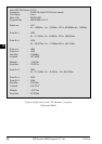
IV
EL
AH
OH
BS
SM
SO
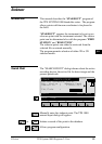
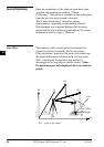
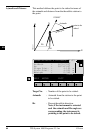
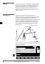
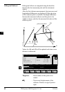
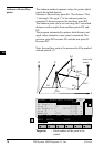
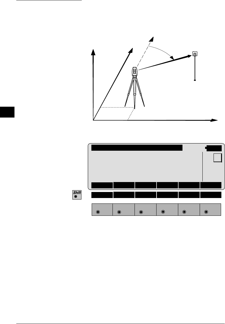
Azimuth and Distance
This method defines the point to be staked in terms of
the azimuth and distance from the theodolite station to
the point.
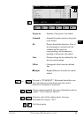
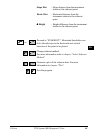
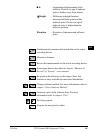
STAKE\AZIMUTH & DISTANCE
14:03
STAKE
F1
F2 F3
F4
F5 F6
HELP METHD PLOT
MC
Target no. : CURB
Azimuth : 90°10'02"
Hz : 98°34'45"
Slope Dist. : 4.105 m
Horiz.Dist. : 4.021 m
∆Height : 0.340 m
Target No. : Number of the point to be staked.
Azimuth : Azimuth from the station to the point
to be staked.
Hz : Present theodolite direction.
Note, if the instrument is oriented
and the azimuth and Hz angle are
corresponding, the instrument is
pointing to the point to be staked.
PROG_Z07
H
N
E
E0
N0
0°00'00"
Azimuth
Slope Dist.
point to be
staked