


278 TPS-System 1000 Programs-2.3.1en © Leica
IV
EL
AH
OH
BS
SM
AS
FS
BL
HB
KM
FB
SA
PZ
LB
TB
CO
RP
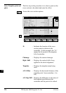
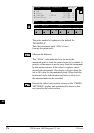
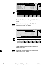
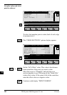
ROAD+\ POINT COORDS
14:03
MC
Chainage : 25.000
Refl.Height : 1.500 m
Easting : 337.000 m
Northing : 340.500 m
Elevation : 31.200 m
STAKE EDIT
F1
F2 F3
F4
F5 F6
HELP
To stake the offset point on the right side for chainage
25+00:
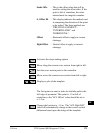
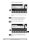
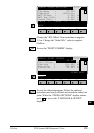
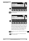
Activates the stakeout program. The "POLAR
STAKEOUT" display will appear.
STAKE\ POLAR STAKEOUT
14:03
MC
Target no. : 5
∆ Hz : 0°00'00"
∆ Dist : 0.010 m
∆ Height :FILL 0.950 m
Elevation : 33.187 m
ALL DIST REC TARGT αNUM
F1
F2 F3
F4
F5 F6
HELP METHD PLOT
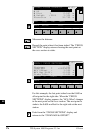
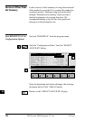
Use the normal procedure previously outlined for
staking out the point.
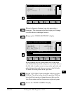
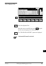
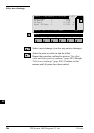
Records the staked out position and returns to the
"CROSS SECTIONS" display.