


108 TPS-System 1000 Programs-2.3.1en © Leica
IV
EL
AH
OH
BS
SM
AS
FS
BL
RH
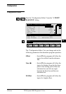
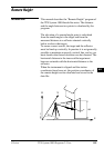
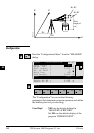
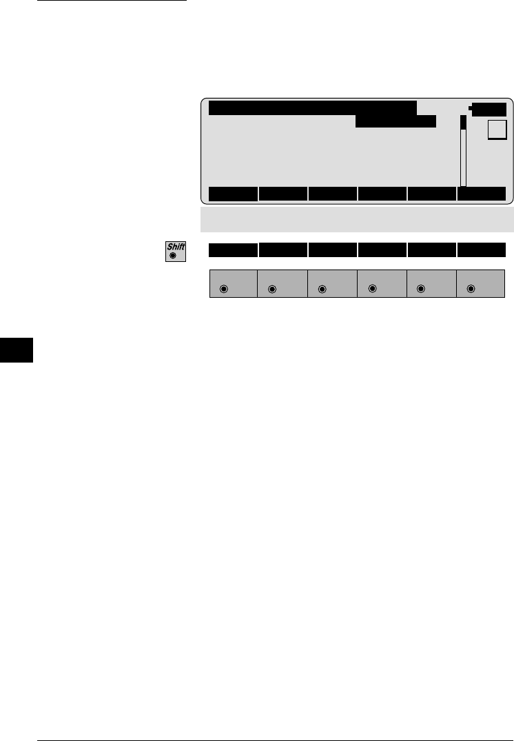
Measure Remote Point
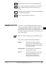
Once the base point has been measured, this dialog
shows the position of the point - above or below the
base point - aimed with the telescope. The data are
immediately updated while turning the instrument.
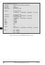
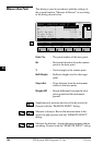
REMHT\ MEASURRE REMOTE PT
14:03
Northing : 124.003 m
Elevation : 768.005 m
MC
Point no. : Station12
Hz : 16°55'50"
V : 91°16'20"
Slope Dist. : 23.345 m
∆Hgt diff : 6.435 m
Easting : 3453.998 m
STORE TARGT BASE
F1
F2 F3
F4
F5 F6
HELP I<>II
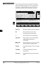
Point No. : The point number of the remote point.
Hz : Horizontal direction from the
instrument to the remote point.
V : Vertical angle to the remote point.
Slope dist. : Slope distance from the instrument
station to the remote point.
(calculated)
∆∆
∆∆
∆ Hgt diff : Height difference between the remote
point and the base point ground.
Easting : Calculated Easting (Y) for the remote
point.
Northing : Calculated Northing (X) for the
remote point.
Elevation : Calculated Elevation for the remote
point.