


© Leica TPS-System 1000 Programs-2.3.1en 183
IV
EL
AH
OH
BS
SM
AS
FS
BL
HB
KM
FB
SA
PZ
RO
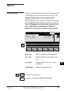
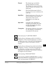
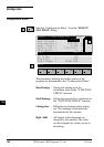
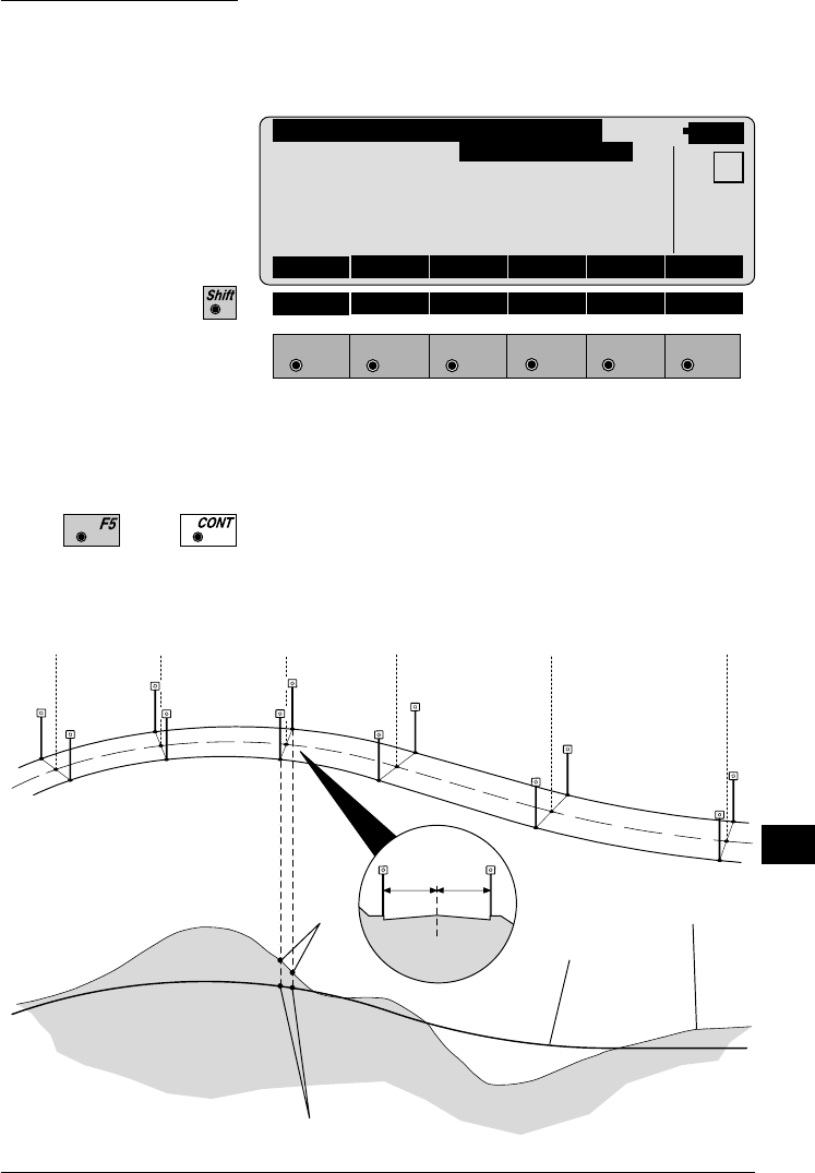
The coordinates of a stakeout point are displayed and
passed to the program "STAKEOUT".
Stakeout
F1
F2 F3
F4
F5 F6
HELP END
ROADL\ POINT COORDS
14:03
MC
Chainage : 34225.000
Refl.Height : 1.634 m
Easting : 1010.567 m
Northing : -34213.077 m
Elevation : 345.655 m
STAKE
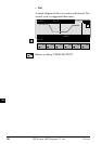
The coordinates calculated from the input values of the
dialog "CHAINAGE & OFFSET" or "CROSS
SECTION" are displayed.
Calls program "STAKEOUT". The coordinates
displayed are transferred.
or
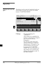
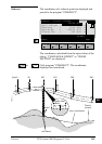
[km] 0 50 100 150 200 300
PROG_Z27
calculated
Line (calculated)
actual
centre-line
offset
(-) (+)
Terrain
(actual)