


268 TPS-System 1000 Programs-2.3.1en © Leica
IV
EL
AH
OH
BS
SM
AS
FS
BL
HB
KM
FB
SA
PZ
LB
TB
CO
RP
2. Copy the alignment and template files to your
PCMCIA card. Copy the files into the GSI
subdirectory on your PCMCIA card. If the GSI
subdirectory doesn’t already exist on the PCMCIA
card, you will need to create one. Place the PCMCIA
card in your instrument.
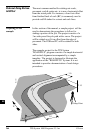
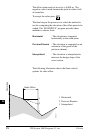
3. Set up the instrument in your work area and
stakeout the example roadway. Set the instrument
coordinates to the values shown for point 1 (see
figure page 264). Orient the instrument towards a
convenient "North", and set Hzo to zero (see figure
page 264). Start "ROADPLUS" and continue reading
this manual.
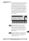
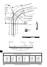
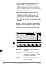
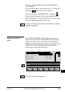
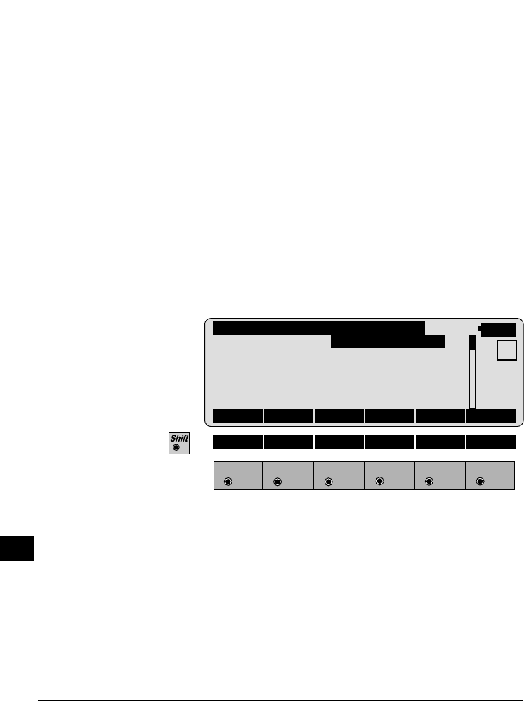
When the "CHAINAGE & OFFSET" display appears,
only the lower portion beginning with "Station" will be
visible. To view the entire display, use the green up/
down arrow keys on the keyboard to scroll up to the
top.
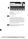
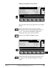
ROAD+\ CHAINAGE & OFFSET
14:03
MC
Hght. Shift : 0.000 m
Chainge Incr : 25.000
Chainge : 0.000
Element : POB
Offset : 0.000 m
Hght Offset : 0.000 m
CHECK CH--> <--CH XSEC EDIT
F1
F2 F3
F4
F5 F6
HELP STORE StaEq NOTE
Hght. Shift : Vertical shift applied to the whole
alignment.
Chainge Incr : The chainage increment set in the
configuration is displayed. If desired,
a new value can be entered.
Chainage : Enter the chainage location for the
points to be staked.